
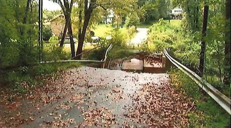
Picture of the collapsed bridge snapped in the light of day after the incident
Robert W. Zimmerman, one of the attorneys representing the Paxson family said, “For nine years, the community of Hickory was needlessly and senselessly placed at risk, when a road-bridge collapsed in 2013, and when one of the largest companies in the world refused to correct its mapping algorithms despite repeated pleas. For years before this tragedy, Hickory residents asked for the road to be fixed or properly barricaded before someone was hurt or killed. Their demands went unanswered.”
At the time Google Maps showed that the road, which included the collapsed bridge, was passable
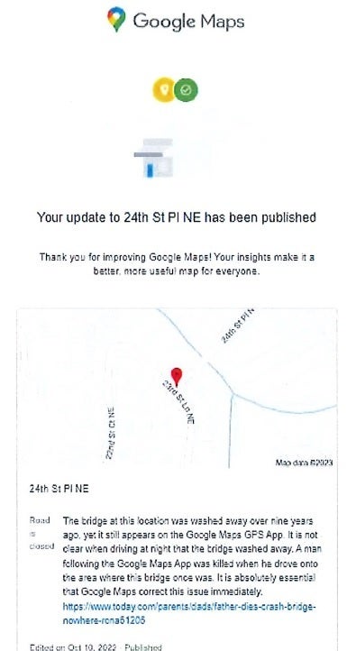
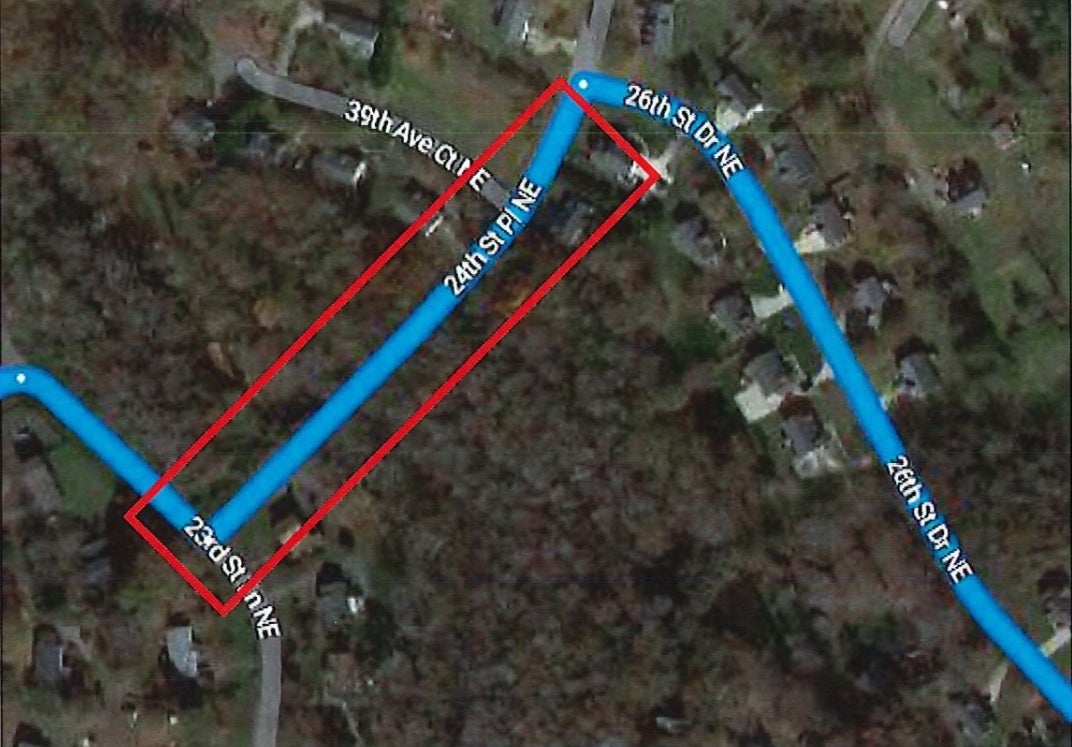
Google finally edits Google Maps to stop leading drivers to the collapsed bridge
Honestly, this should worry all of us who depend on a mapping and navigation app to get around, especially when it is dark outside and visibility is poor. If you’re driving in an area that you’re not familiar with, it might not be a bad idea to call the non-emergency phone number of the police department in the city of your destination and ask them if there is anything about the local roads that you should know about.