
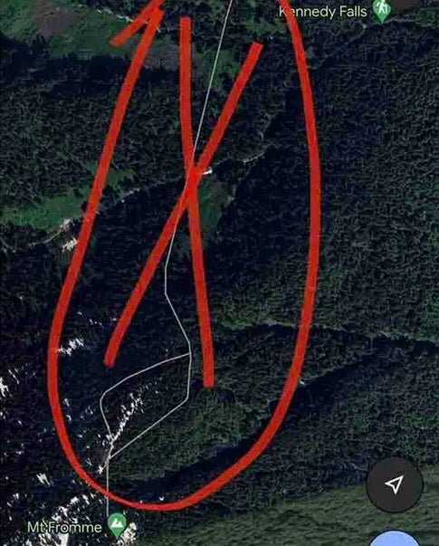
The walking trail seen on Google Maps by the hiker did not exist
The rescue team was at first unable to spot the hiker due to the trees that blocked their view. Two of the technicians flying in the helicopter were lowered onto the mountain and had to hike their way up. After finding the stranded hiker, they placed him in a harness and took him down to an area where all three of them could be safely picked up by the helicopter.
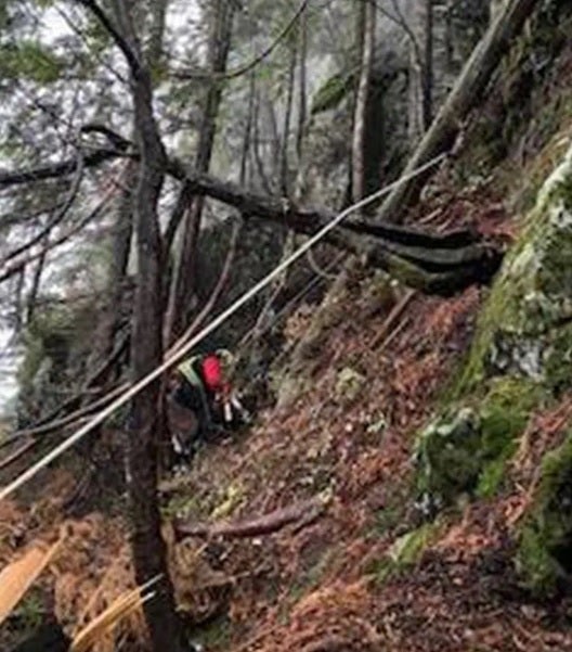
Rescuers were lowered to the side of the mountain from the helicopter
Seeking to prevent a similar situation from happening again, the rescue group issued some warnings to hikers. “First, it is simply not appropriate to navigate in the wilderness using ‘urban street map’ programs like Google Maps,” the team said. They recommended that hikers go ‘old school’ and use a compass with a paper map and follow posted signs in the area that warn of approaching dangers.